|
Site Map
Click on the
following web pages for more offerings:
HOME
About Us
Colorado
Artifactual
Albertype
Publications
Aspen,
Colorado
Business
Directories
Colorado
Colorado
Bottles, historical
Colorado
Business Directories
Colorado Maps
Colorado
Mining Stock Certificates
Colorado
Whiskey Jugs, historical
Cripple Creek,
Colorado
Cripple
Creek Mining Directories
Cripple
Creek mining stock certificates
Denver and
Rio Grande Railroad
Einstein,
Albert
Feynman,
Richard P.
Fitzgerald, F.
Scott
Gunnison
County, Colorado, including Crested Butte
Hecht, Ben
Hemingway,
Ernest
Hutchinson
Soda Bottles
Leadville,
Colorado
Leadville
Directories
San Juan
Mountains, Colorado
Silverton
Railroad
|
|
Yes, we Accept:
PAYPAL,
Venmo & SQUARE |
We
are always interested in purchasing, whether you have a single item or an entire
collection for sale.
© 2022 Mt. Gothic Tomes
| |
|
WESTERN
AMERICAN EXPLORATION, Page 1 |
|
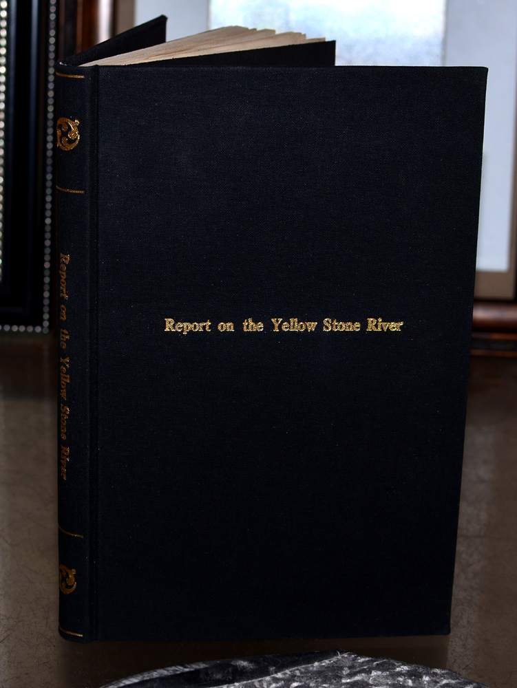
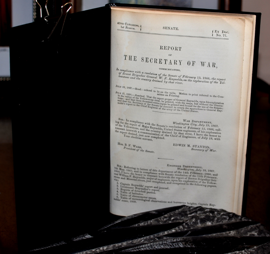
REPORT
OF THE SECRETARY OF WAR
Edwin
M. Stanton, A.A. Humphreys. Civil of Engineers, Major General
Journal
of Captain W.F. Raynolds, United States Army, Corp of Engineers.
First edition. 174 pages, with large folding map entitled,
"Map of the Yellowstone and Missouri Rivers and Their
Tributaries." |
|
Brevet
Brigadier General W. F. Raynolds
Report
on the Exploration of the Yellowstone River and the country drained by
that river, with map, extracted from Senate Document No. 77, 40th
Congress, 1st Session
1868 |
|
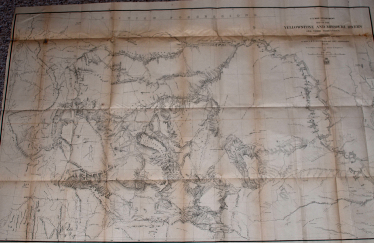
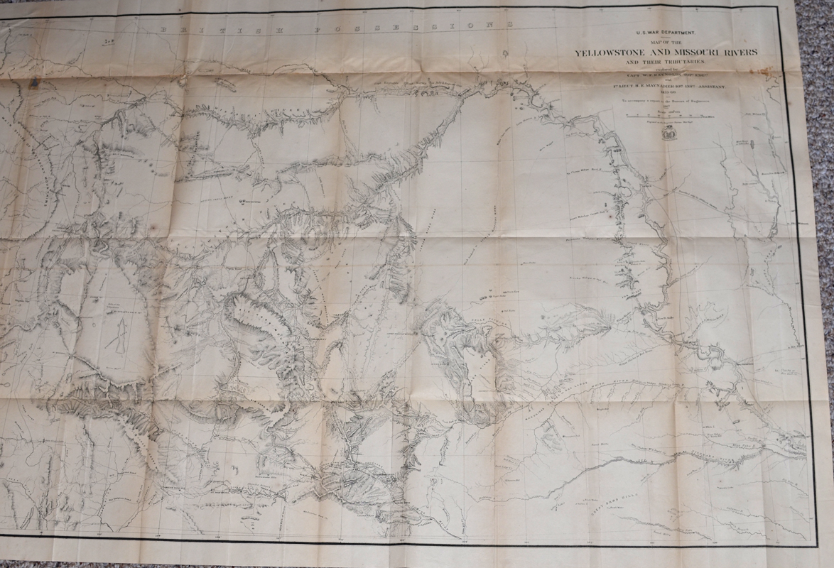
U.S.
War Department issue. Map of the Yellowstone and Missouri Rivers and
Their Territories, explored by Capt. W.F. Raynolds, Topographical Engineer
and 1st Lieutenant H.A. Maynadier, 10th Infantry, Assistant.
1859-1860. To Accompany a Report to the Bureau of Engineers,
1867. Engraved in the Engineering Bureau. |
|
Dimensions
of map: 42 inches by 29 inches. Condition: very good; some
conservation reinforcement to back of hinges; some conservation work to
tears on back of map; use of neutral pH archival materials. Some
darkening of paper at hinges; however, overall map is in bright, clean
condition with sharp and concise detail. This map was considered
one of the most significant published up to the date for any travelers
or settlers desiring to migrate to the northwest territories.
|
|
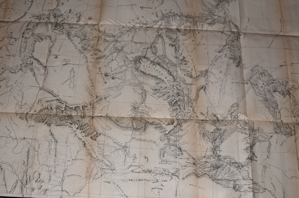
Topographical
details and locations include: Black Hills; Big Horn Mountains; Chetish or
Wolf Mountains; Judith Mountains; Belt Mountains; Red Buttes; Fort C.F.
Smith; Yellowstone Lake; South Pass Station; Powder River; Ft. Phil
Kearny; Yellowstone River; Missouri River; and numerous others. |
|
Original
report has been extracted and rebound in black cloth with gold print on
cover and spine; overall, in very good plus condition.
Price
for book and map: SOLD |
|