|
Site Map
Click on the
following web pages for more offerings:
HOME
About Us
Colorado
Artifactual
Albertype
Publications
Aspen,
Colorado
Business
Directories
Colorado
Colorado
Bottles, historical
Colorado
Business Directories
Colorado Maps
Colorado
Mining Stock Certificates
Colorado
Whiskey Jugs, historical
Cripple Creek,
Colorado
Cripple
Creek Mining Directories
Cripple
Creek mining stock certificates
Denver and
Rio Grande Railroad
Einstein,
Albert
Feynman,
Richard P.
Fitzgerald, F.
Scott
Gunnison
County, Colorado, including Crested Butte
Hecht, Ben
Hemingway,
Ernest
Hutchinson
Soda Bottles
Jackson,
William Henry
Leadville,
Colorado
Leadville
Directories
San Juan
Mountains, Colorado
Silverton
Railroad
|
|
Yes, we Accept:
PAYPAL,
Venmo & SQUARE |
We
are always interested in purchasing, whether you have a single item or an entire
collection for sale.
© 2024 Mt. Gothic Tomes
| |
|
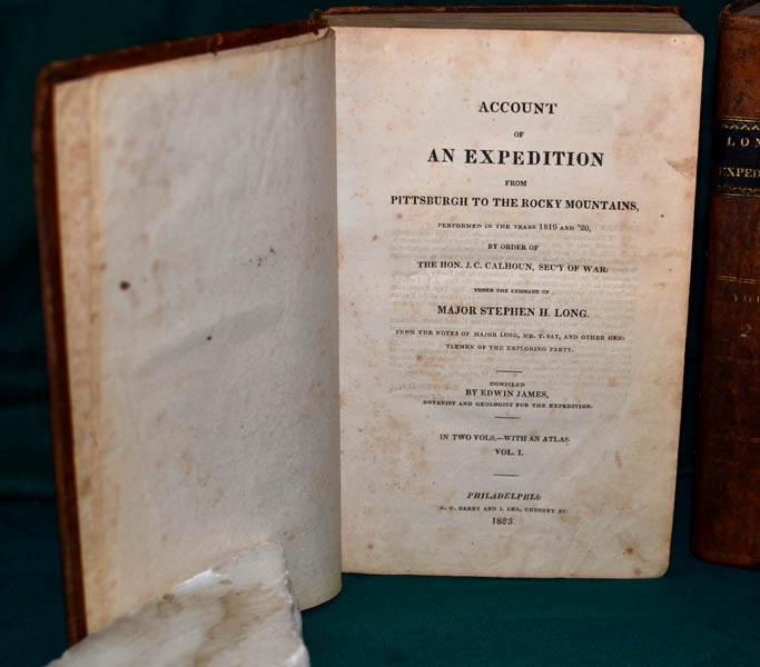
ACCOUNT
OF AN EXPEDITION FROM PITTSBURGH TO THE ROCKY MOUNTAINS, Performed
in the years 1819 and 1820, by Order of The Hon. J.C. Calhoun, Secretary
of War: Under the Command of MAJOR STEPHEN H. LONG. From the Notes
of Major Long, Mr. T. Say, and other Gentlemen of the Exploring
Party. Compiled by Edwin James, Botanist and Geologist for the
Expedition. In Two Volumes -- with an Atlas. Philadelphia:
H.C. Carey and I. Lea, Chestnut Street. 1823.
|
|
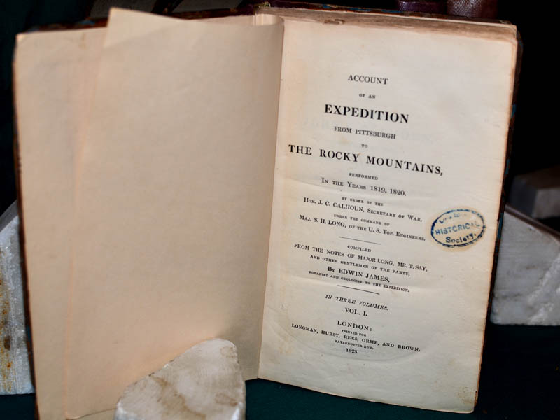
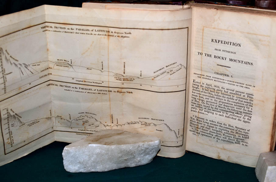
ACCOUNT
OF AN EXPEDITION FROM PITTSBURGH TO THE ROCKY MOUNTAINS, Performed
in the years 1819, 1820, by Order of The Hon. J.C. Calhoun, Secretary of
War: Under the Command of MAJOR STEPHEN H. LONG. From the Notes of
Major Long, Mr. T. Say, and other Gentlemen of the Exploring
Party. Compiled by Edwin James, Botanist and Geologist for the
Expedition. In Three Volumes. London: Printed for Longman,
Hurst, Rees, Orme, and Brown, Paternoster - Row. 1823. This
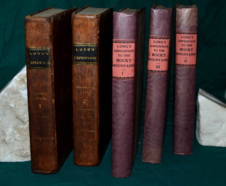
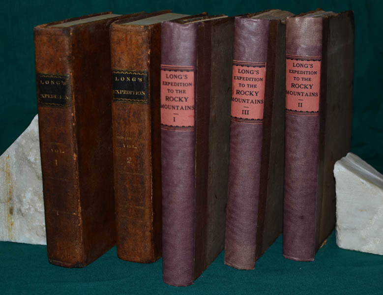
offering is a hybrid of both the American and British first
editions. The first American volumes (2) are bound in original
leather with original tipped on spine titles. The first British
volumes (3) are bound in original boards with re-cased spines and tipped
on spine titles. Interior end-papers of first American volumes are
original and have "Sempronium Library" handwritten on first
end-paper. End-papers of British volumes have been replaced; and,
on title pages of each is stamped, "Long Island Historical
Society." All of these volumes have been properly and
officially de-acquisitioned. |
|
Volumes of the
American edition are in very good plus condition; however, there is
light foxing throughout. The British volumes exhibit very little,
if any, foxing, and are in near fine condition. American volumes:
Volume I, pages 1 - 503; Volume II, pages 1 - 442; plus, Astronomical
and Meteorological Records and Vocabularies of Indian Languages,
Taken on the Expedition for Exploring the Mississippi and Its Western
Waters, under the Command of Major S. H. Long, of the United States
Topographical Engineers, 1819 and 1820, Philadelphia, 1822, plus
index. British volumes: Volume I, pages 1 - 344, London: Printed
by A. & R. Spottiswoods, New-Street-Square; Volume II, pages 1 -
356, London: Printed by A. & R. Spottiswoods, New-Street-Square;
Volume III, pages 1 - 347, London: Printed by A. & R. Spottiswoods,
New-Street-Square.
|
|
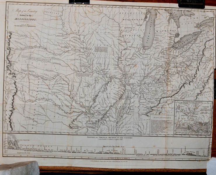
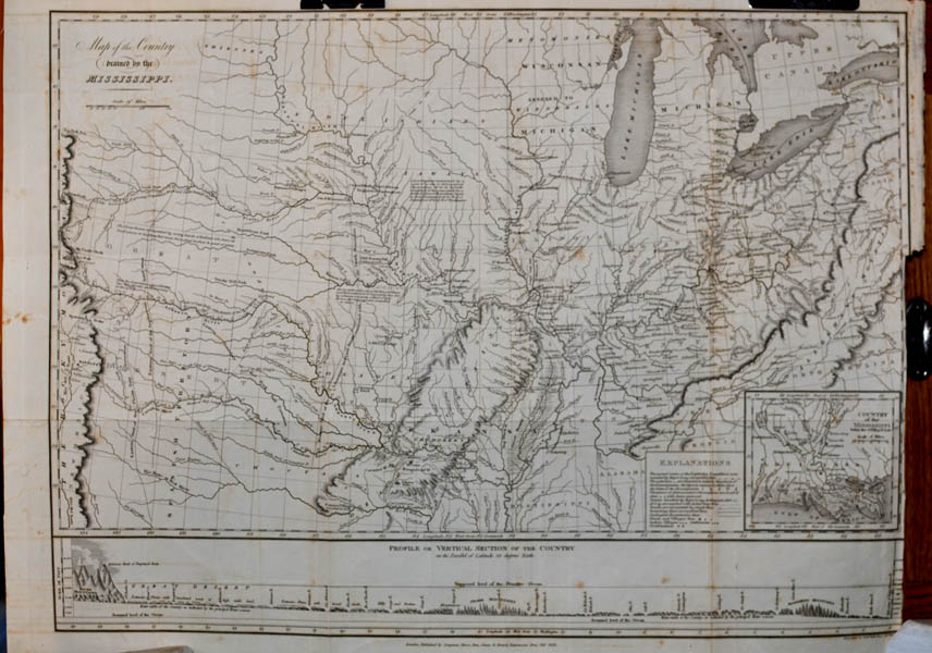
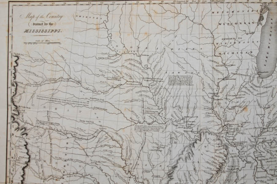
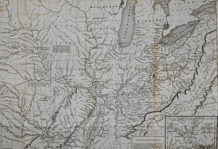
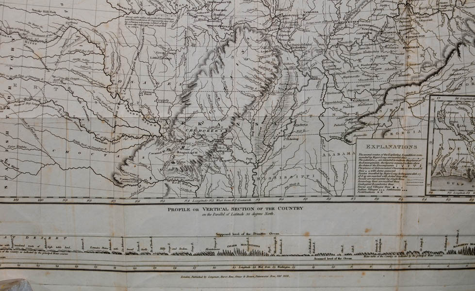
Original
map: MAP OF THE
COUNTRY DRAINED BY THE MISSISSIPPI and PROFILE OR VERTICAL
SECTION OF THE COUNTRY on the Parallel of Latitude 38 degrees
North. London, Published by Longman, Hurst, Rees, Orme &
Brown, Praternoster Row, February 1823. Dimensions: approximately
21-1/2 inches in width and 16 inches in height. Folded.
Overall: very good plus condition; original and complete to the British
edition. |
|
British Volume I also contains
foldout plate of Vertical Section of the Parallel of Latitude for 41-
and 35-degrees. |
|
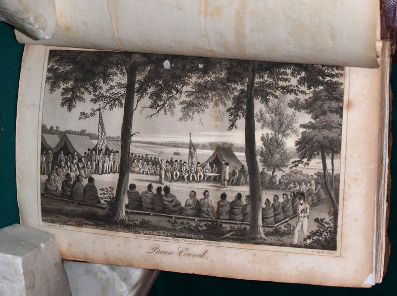
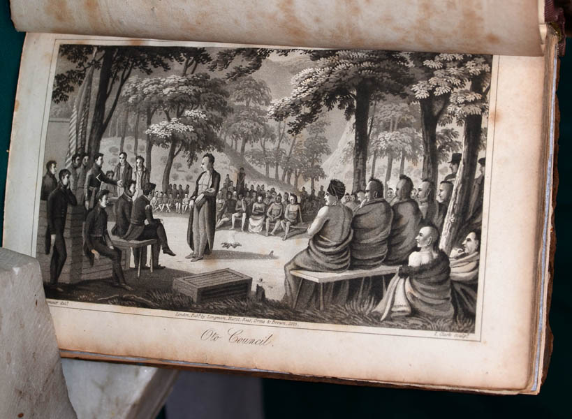
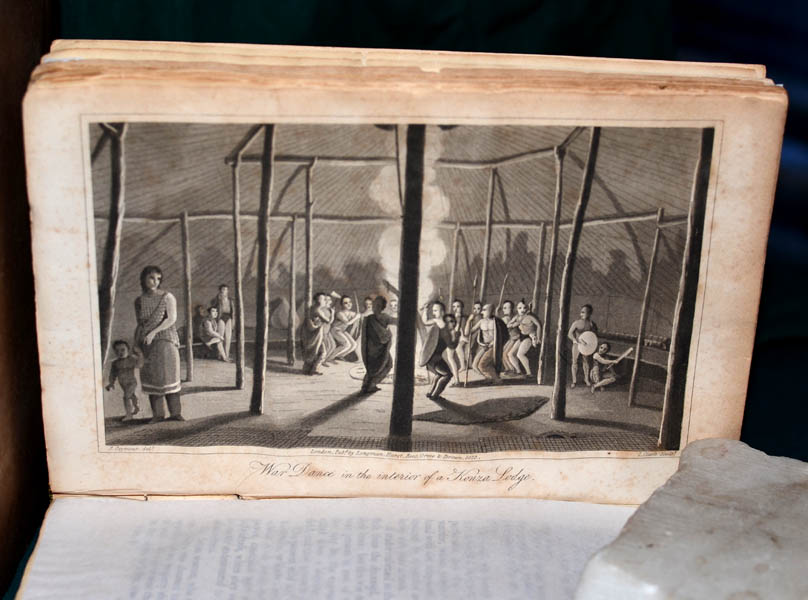
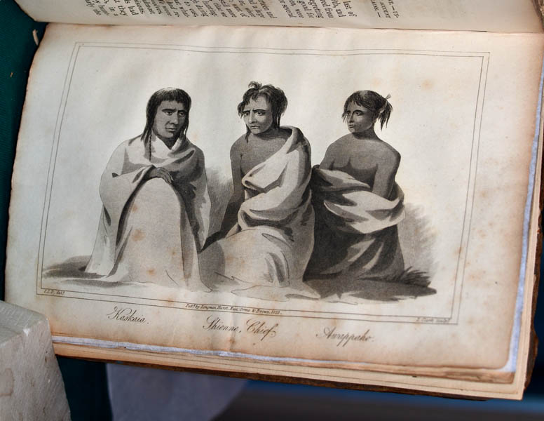
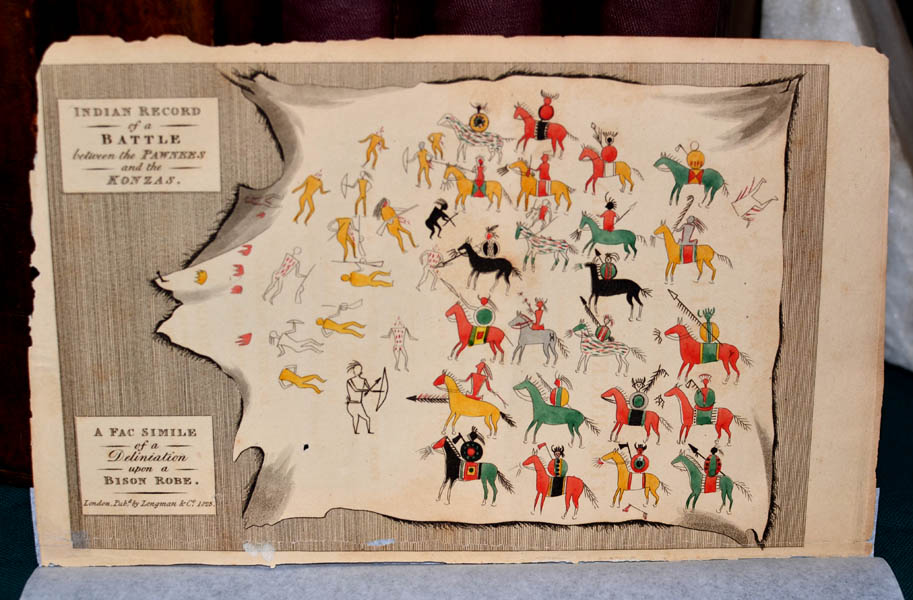
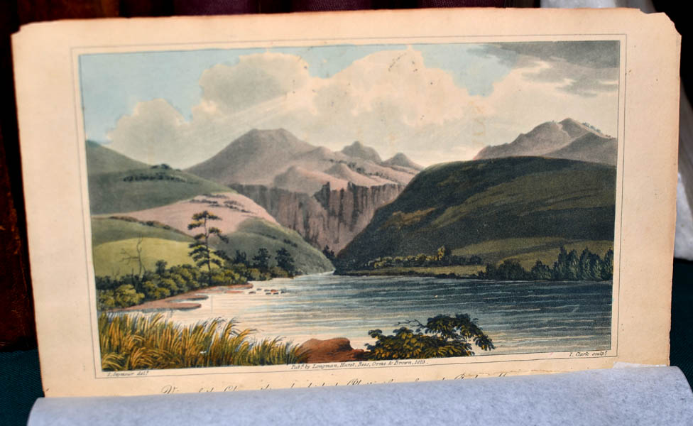
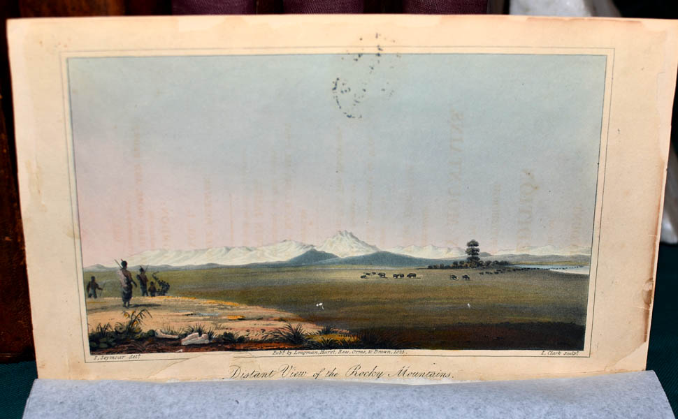
This set also contains the 8
plates, 3 of which are colored, from the first British edition. |
|
Set of
5 volumes, original map, vertical sections, and 8 plates sold as a
set. Overall condition: very good; some fragility.
Price:
$9,750.00 |
|