|
Site Map
Click on the
following web pages for more offerings:
HOME
About Us
Colorado
Artifactual
Albertype
Publications
Aspen,
Colorado
Business
Directories
Colorado
Colorado
Bottles, historical
Colorado
Business Directories
Colorado Maps
Colorado
Mining Stock Certificates
Colorado
Whiskey Jugs, historical
Cripple Creek,
Colorado
Cripple
Creek Mining Directories
Cripple
Creek mining stock certificates
Denver and
Rio Grande Railroad
Einstein,
Albert
Feynman,
Richard P.
Fitzgerald, F.
Scott
Gunnison
County, Colorado, including Crested Butte
Hecht, Ben
Hemingway,
Ernest
Hutchinson
Soda Bottles
Jackson,
William Henry
Leadville,
Colorado
Leadville
Directories
San Juan
Mountains, Colorado
Silverton
Railroad
|
|
Yes, we Accept:
PAYPAL,
Venmo & SQUARE |
We
are always interested in purchasing, whether you have a single item or an entire
collection for sale.
© 2024 Mt. Gothic Tomes
| |
|
|
|
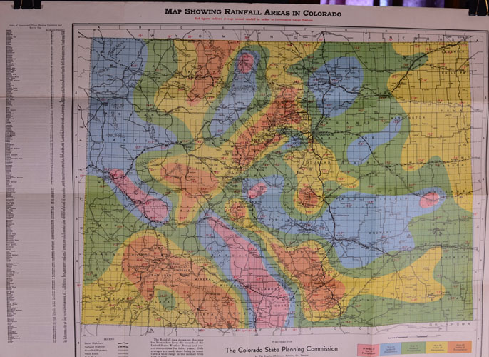
(Colorado
State Planning Commission) MAP
SHOWING RAINFALL AREAS OF COLORADO, revised and copyrighted 1936.
Published for The Colorado State Planning Commission by The
Bradford-Robinson Printing Co., Denver.
“Red figures indicates average annual rainfall in inches at
Government Gauge Stations.” 5-color
map. Dimensions: 23-1/2 inches
across by 18 inches in height. Legend
shows Paved Highways, Surfaced Highways, Gravelled Highways, Other Roads,
and U.S. Highways. Rainfall
data from US Weather Bureau and covers observations for 30 years.
Near fine condition; folded.
|
|
PRICE:
$95.00 |
|
|
|
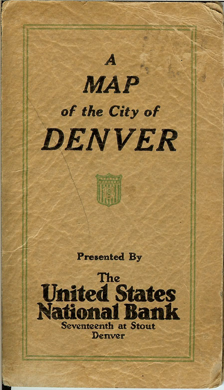
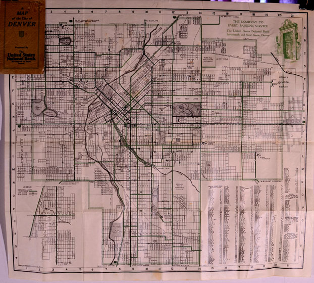
(The
Daniel – Smith Co., Denver) A
MAP OF THE CITY OF DENVER, circa 1929.
Presented by The United States National Bank, Seventeenth and
Stout, Denver, Colorado. Green
and black print. Lot, block,
and subdivision map with Denver street index and inset map of Englewood.
In original printed tan folder.
Dimensions of map: 17-3/4 inches across by 16 inches in height.
Very good plus condition.
PRICE:
$200.00
|
|
|
|
|
|
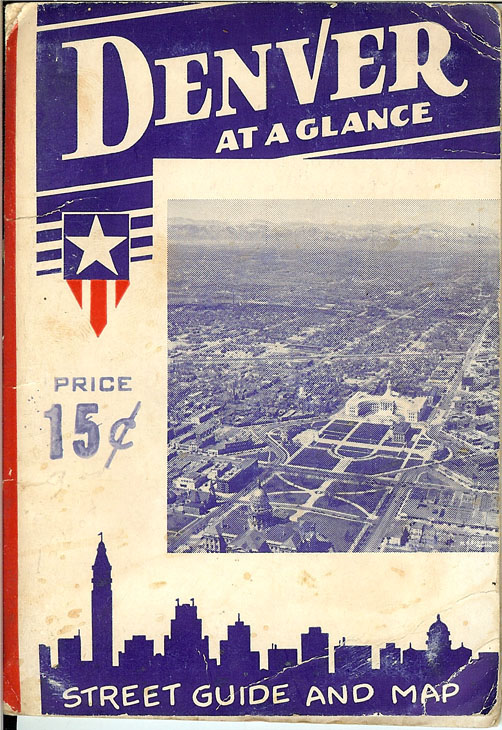
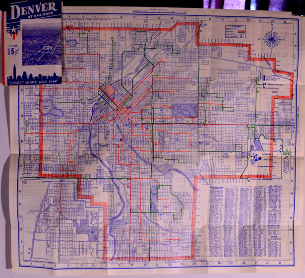
(The
Daniel – Smith Co., Denver) DENVER
AT A GLANCE, Street Guide and Map, published by Theoren C. Smith,
circa 1939. In original
photographically illustrated folder. Dimensions:
17-3/4 inches across and 16 inches in height.
Blue, red and green print; 15 cents on cover. Lot,
block, street and subdivision map. Printed
local advertisements on back of map. Near
fine condition.
PRICE:
$85.00
|
|
|
|
|
|
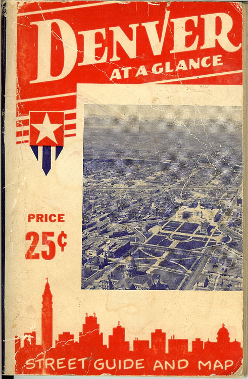
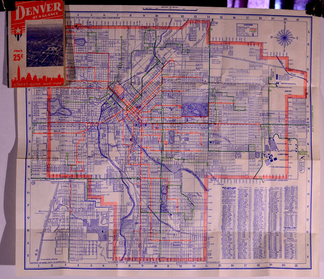
(The
Daniel – Smith Co., Denver) DENVER
AT A GLANCE, Street Guide and Map, published by Theoren C. Smith,
circa 1940. In original
photographically illustrated folder. 80-page
booklet included. Dimensions:
17-3/4 inches across and 16 inches in height.
Blue, red and green print. Lot,
block, street and subdivision map. Printed
local advertisements on back of map; 25 cents on cover. Near
fine condition.
PRICE:
$75.00
|
|
|
|
|
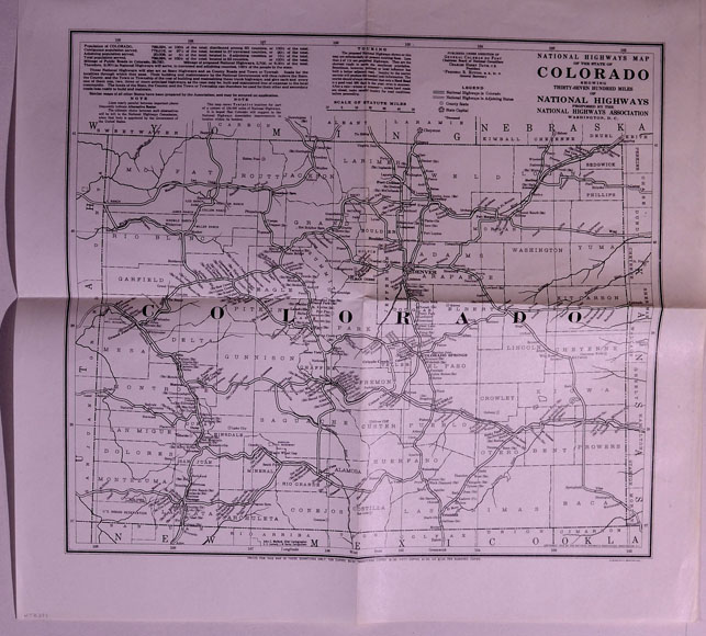
(Du
Pont, Coleman, National Highways) NATIONAL
HIGHWAYS MAP OF THE STATE OF COLORADO, Showing Thirty-Seven
Hundred Miles of National Highways Proposed by the National Highways
Association, Washington, D.C. Published
under the direction of General Coleman du Pont, Chairman Board of
Councillors, Charles Henry Davis, C.E., President, Frederic R. Hutton, M.E.,
Sc. D., General Secretary). Circa
1929. Dimensions: 15-1/2
inches across by 14-1/2 inches in height.
Near fine condition; folded. |
|
PRICE:
$75.00
|
|
|
|
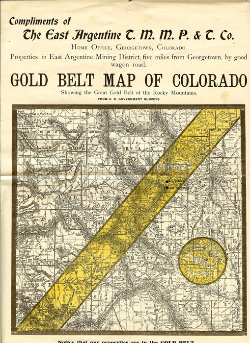
(East
Argentine Mining District, Colorado) GOLD
BELT MAP OF COLORADO, Showing the Great Gold Belt of the Rocky
Mountains, circa 1896, from U.S. Government Surveys.
“Compliments of The East Argentine Tunnel, Mining, Milling,
Prospecting and Transportation Company,” Georgetown Colorado.
“Properties in East Argentine Mining District, five miles from
Georgetown by good wagon road. Dimensions:
9 inches across by 12 inches. Section
of State of Colorado map with demarcations of “gold belt” and
Company’s mining property. Near
fine condition; folded once.
|
|
PRICE:
$200.00
|
|
|
|
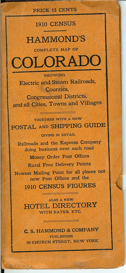
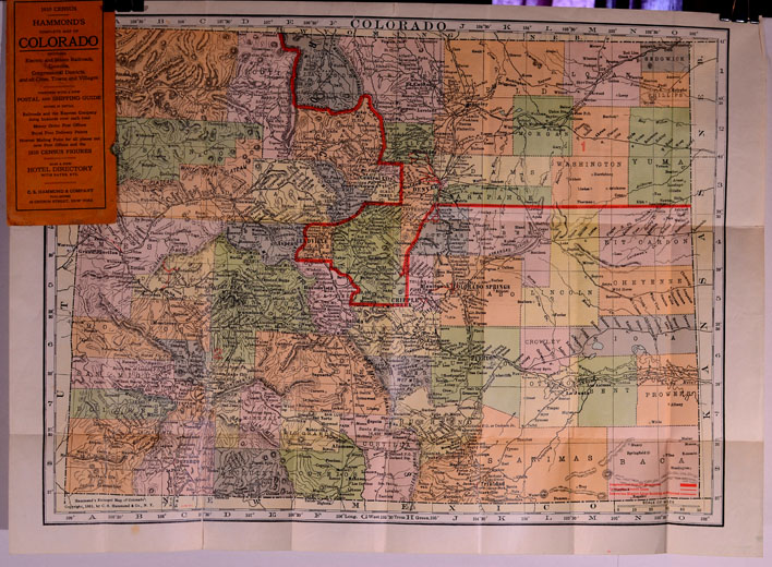
(Hammond,
C. S. pocket map) HAMMOND’S
COMPLETE MAP OF COLORADO, showing Electric and Steam Railroads,
Counties, Congressional Districts, and all Cities, Towns and Villages,
together with a new Postal and Shipping Guide, giving in detail Railroads
and the Express Company doing business over each road, Money Order Post
Offices, Rural Free Delivery Points, Nearest Mailing Point for all places
not now Post Offices and the 1910 Census Figures.
Also a New Hotel Directory with rates, etc.
C. S. Hammond & Company, 30 Church Street, New York, 1911.
Printed in 5 colors. Original
printed tan folder. Map
dimensions: 24 inches across by 17-1/2 inches in height.
Near fine condition.
PRICE:
$350.00
|
|
|
|