|
Site Map
Click on the
following web pages for more offerings:
HOME
About Us
Colorado
Artifactual
Albertype
Publications
Aspen,
Colorado
Business
Directories
Colorado
Colorado
Bottles, historical
Colorado
Business Directories
Colorado Maps
Colorado
Mining Stock Certificates
Colorado
Whiskey Jugs, historical
Cripple Creek,
Colorado
Cripple
Creek Mining Directories
Cripple
Creek mining stock certificates
Denver and
Rio Grande Railroad
Einstein,
Albert
Feynman,
Richard P.
Fitzgerald, F.
Scott
Gunnison
County, Colorado, including Crested Butte
Hecht, Ben
Hemingway,
Ernest
Hutchinson
Soda Bottles
Jackson,
William Henry
Leadville,
Colorado
Leadville
Directories
San Juan
Mountains, Colorado
Silverton
Railroad
|
|
Yes, we Accept:
PAYPAL,
Venmo & SQUARE |
We
are always interested in purchasing, whether you have a single item or an entire
collection for sale.
© 2024 Mt. Gothic Tomes
| |
|
COLORADO
POCKET MAPS
|
|
|
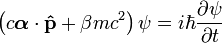
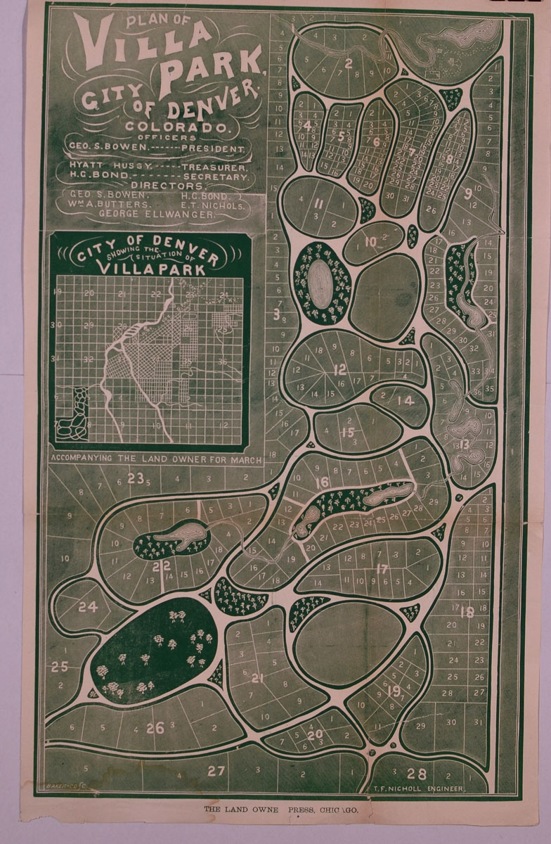
(Bowen,
George S., president) PLAN
OF VILLA PARK, CITY OF DENVER, COLORADO, The Land Owners’ Press,
Chicago, 1874. Map dimensions:
12-1/2 inches across by 21-1/2 inches in height.
Green print on water paper. Drawn
by T. F. Nicholl, engineer. Map
of proposed Villa Park subdivision development with an inset Map of the
City of Denver showing the situation of Villa Park.
Blocks and lots. Very
good plus condition. Printed
by Baker & Co. The Denver
Villa Park Association incorporated on February 10, 1870. George S. Bowen
served as one of six directors during its inception. The tract of land
purchased by the Association consisted of 800 acres, directly west of
Denver. The association settled west of the Platte River and south of
Sloan's Lake. George Bowen remained in Chicago but served as president of
the association. He retained William Holly as his Colorado agent. Early in
1878 the entire operation was sold to Julius J. Gorman.
PRICE:
$950.00
|
|
|
|
|
|
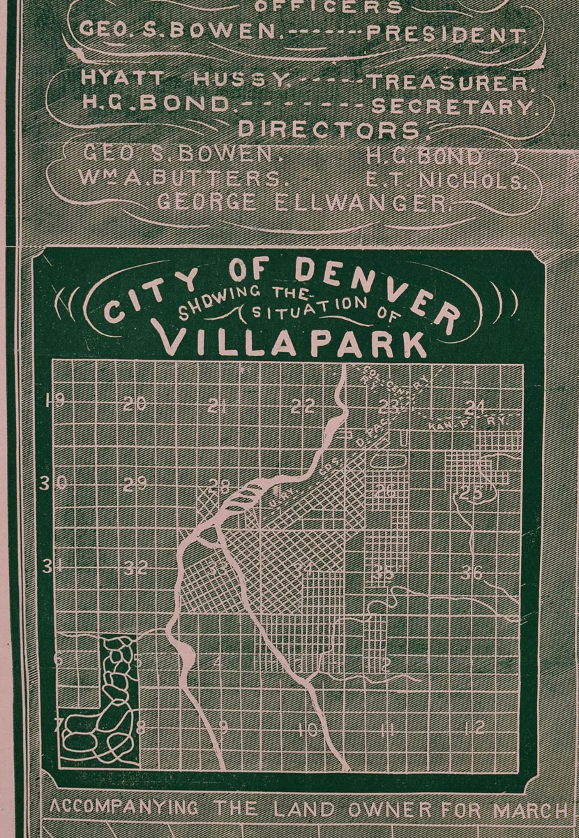
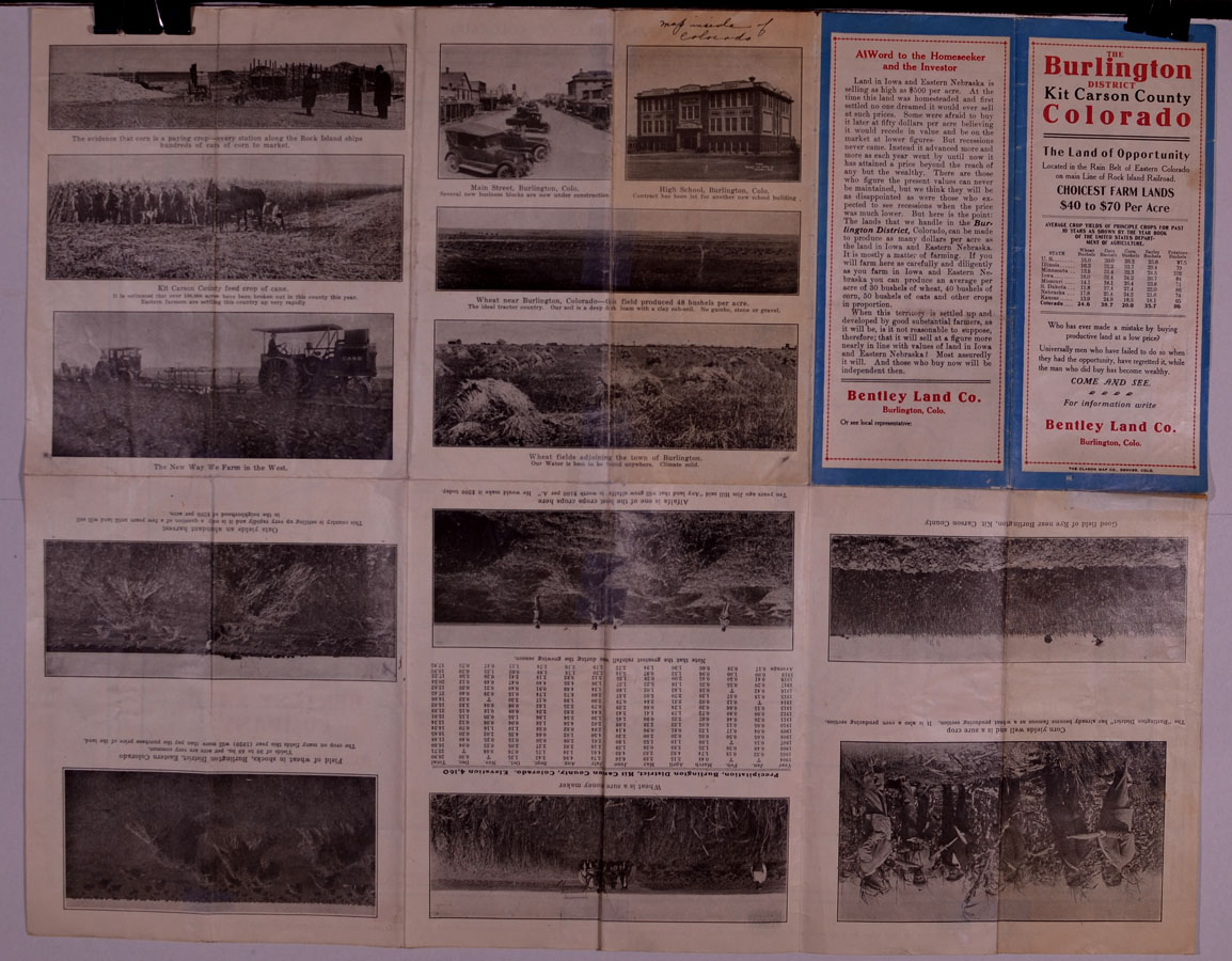
(Clason
Map Company) THE
BURLINGTON DISTRICT: KIT CARSON, COLORADO, 1920.
Pocket map. “The Land
of Opportunity, Located in the Rain Belt of Eastern Colorado on main Line
of Rock Island Railroad. Choicest
Farm Lands, $40 to $70 Per Acre.” Bentley
Land Co., Burlington, Colo. Dimensions:
24 inches across by 19 inches in height; printed on front and back.
MAP SHOWING RAINFALL
AREAS OF COLORADO published for The Colorado State Board of
Immigration by The Clason Map Company, Denver, Colorado.
5-color Colorado map. Index
of towns and cities on right-hand margin.
Circle intentionally printed around Burlington, Kit Carson County,
Colorado. Front side exhibits
panels with 13 photographic images of Kit Carson County, plus 2
descriptive panels. Very good
plus condition; some light reinforcement at hinges.
PRICE:
$250.00
|
|
|
|
|
|
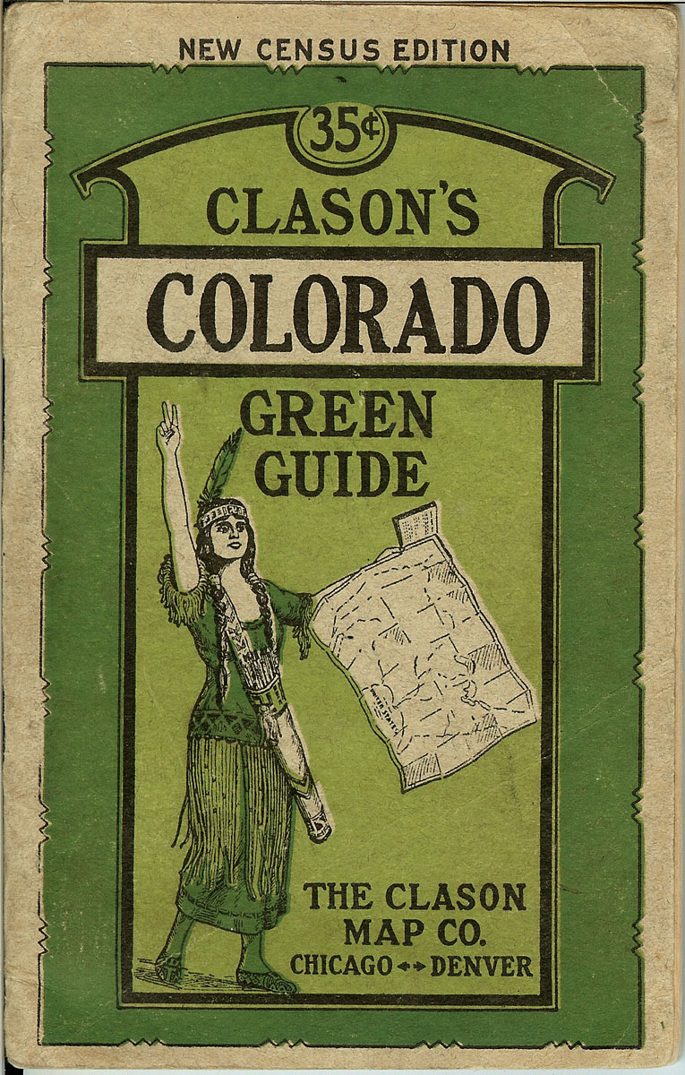
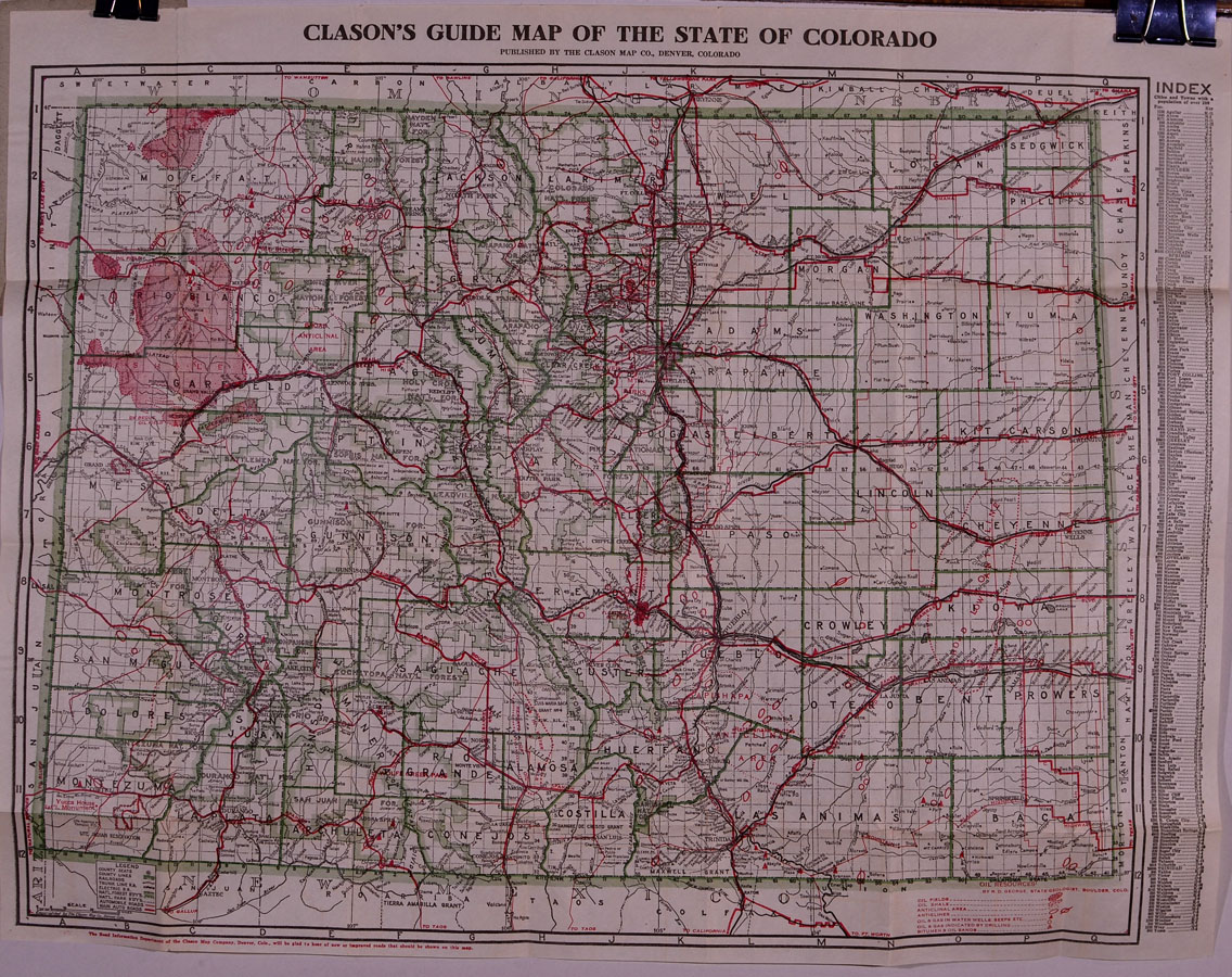
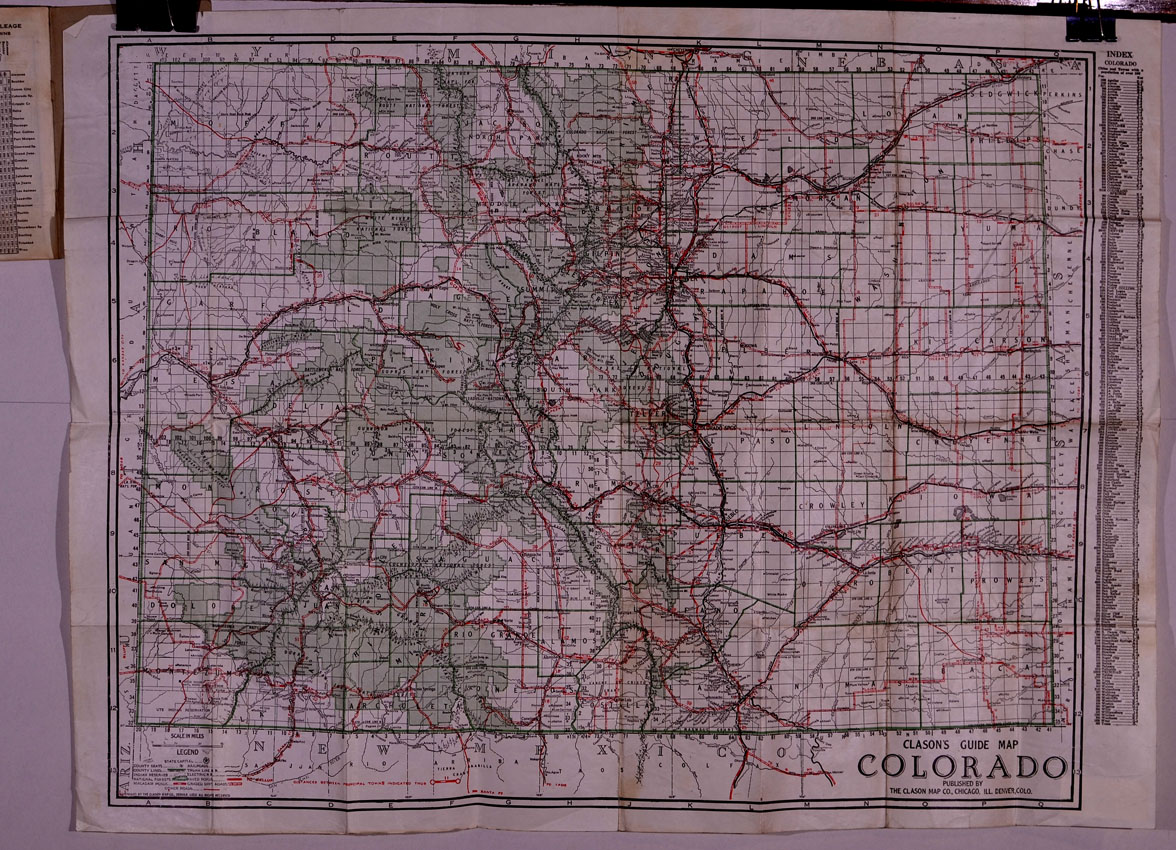
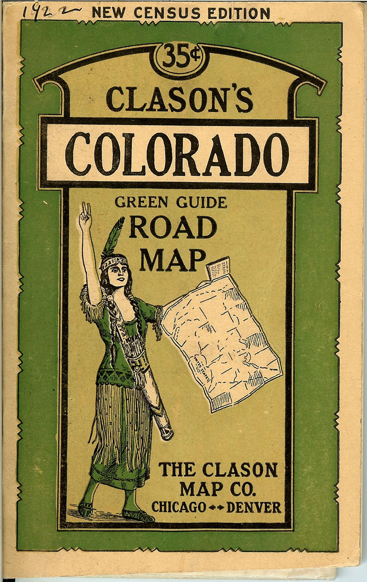
(Clason
Map Company) CLASON’S COLORADO GREEN GUIDE.
Map labeled: Clason’s Guide Map of the State of Colorado.
Circa 1920. The Clason
Map Company, Denver. Original
illustrated green booklet with 40-page index and one foldout sheet with a
map printed on either side. Interior
map showing county seats, county lines, railroads, county lines, trunk
line railroads, electric railroads, national forests boundaries, national
park boundaries, automobile roads, main auto roads.
Oil Resources by R. D. George, State Geologist, Boulder, Colorado:
oil fields; oil shale; anticlinal area; anticlines; oil & gas in water
wells; oil & gas indicated by drilling; bitumen & oil sands.
4-color map. Dimensions
of folding sheet: 23-3/4 inches across by 18-3/4 inches in height.
Condition: very good plus. 4
Colorado city street maps on interior pages.
PRICE:
$250.00
|
|
|
|
|
|
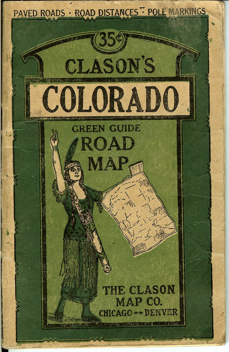
(Clason
Map Company) CLASON’S COLORADO GREEN GUIDE ROAD MAP.
Circa 1921. The Clason
Map Company, Chicago – Denver. Original
illustrated green booklet with 40-page index and one foldout sheet with a
map printed on either side. Interior
map: Clason’s Guide Map of Colorado, showing state capital, county
seats, railroads, county lines, trunk line railroads, Indian reserves,
electric railroads, national forests, paved roads, macadam roads, graded
dirt roads, other roads, distances between principal towns.
4-color map. Dimensions
of folding sheet: 27 inches across by 21 inches in height.
Condition: very good. 4
Colorado city street maps on interior pages.
PRICE:
$250.00
|
|
|
|
|
|
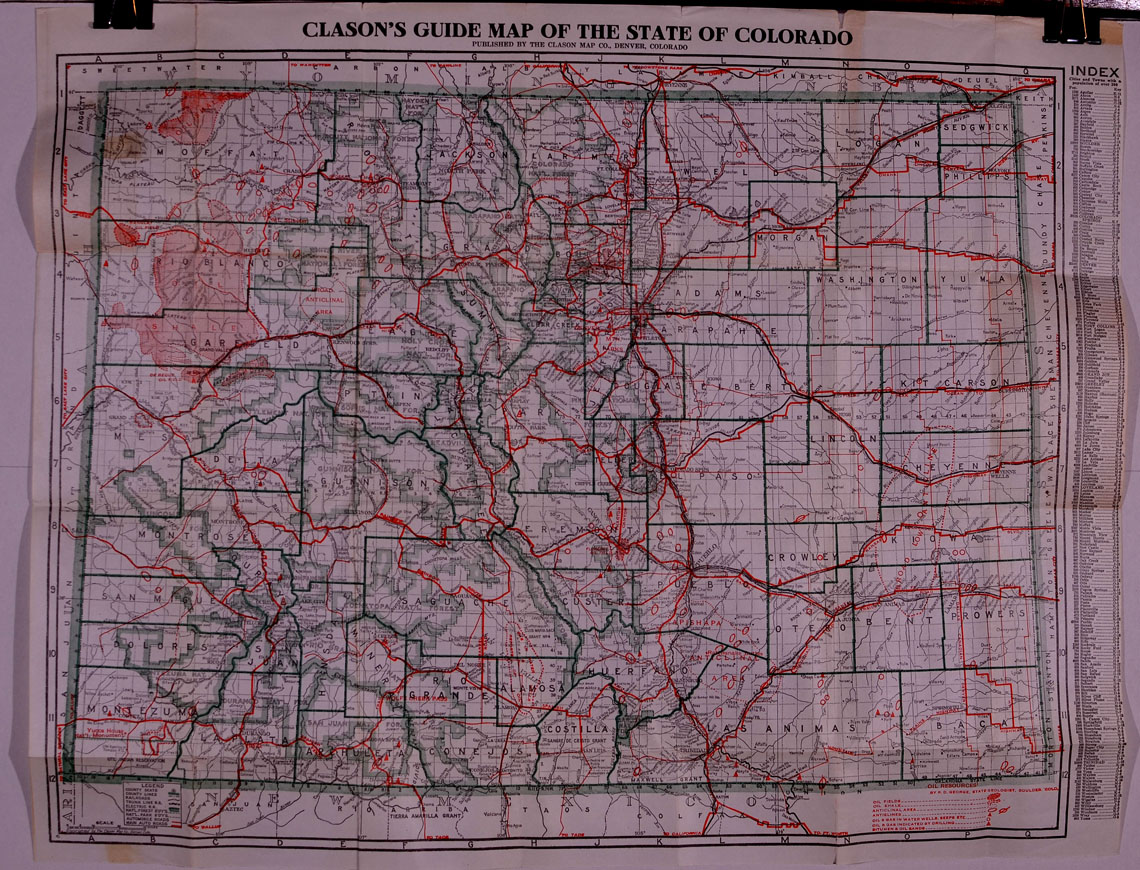
(Clason
Map Company) CLASON’S COLORADO GREEN GUIDE ROAD MAP.
Map labeled: Clason’s Guide Map of the State of Colorado.
Circa 1922. The Clason
Map Company, Denver. Original
illustrated green booklet with 40-page index and one foldout sheet with a
map printed on either side. Interior
map showing county seats, county lines, railroads, county lines, trunk
line railroads, electric railroads, national forests boundaries, national
park boundaries, automobile roads, main auto roads.
Oil Resources by R. D. George, State Geologist, Boulder, Colorado:
oil fields; oil shale; anticlinal area; anticlines; oil & gas in water
wells; oil & gas indicated by drilling; bitumen & oil sands.
4-color map. Dimensions
of folding sheet: 23-3/4 inches across by 18-3/4 inches in height.
Condition: very good plus. 4
Colorado city street maps on interior pages.
PRICE:
$250.00
|
|
|
|
|
|
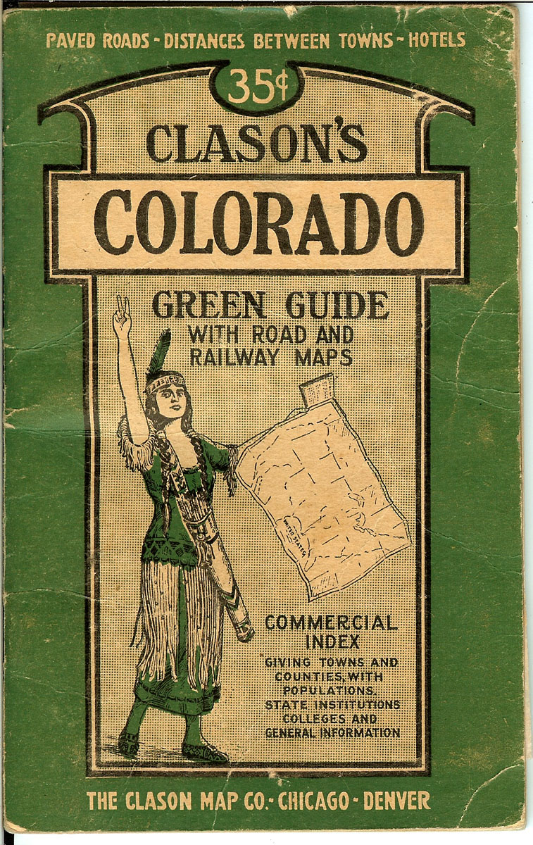
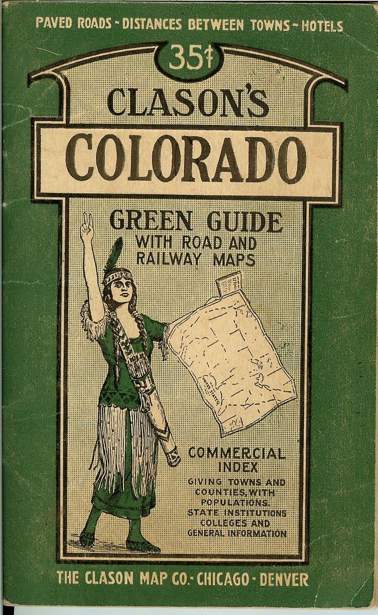
(Clason
Map Company) CLASON’S COLORADO GREEN GUIDE WITH ROAD AND RAILWAY MAPS.
Circa 1923. Commercial
index giving towns and counties, with populations.
State institutions, colleges and general information.
The Clason Map Company, Chicago – Denver.
Original illustrated green booklet with 40-page index and one
foldout sheet with a map printed on either side.
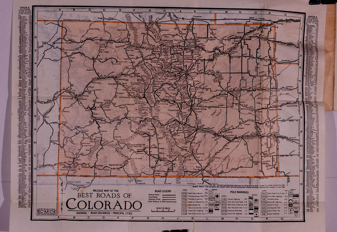
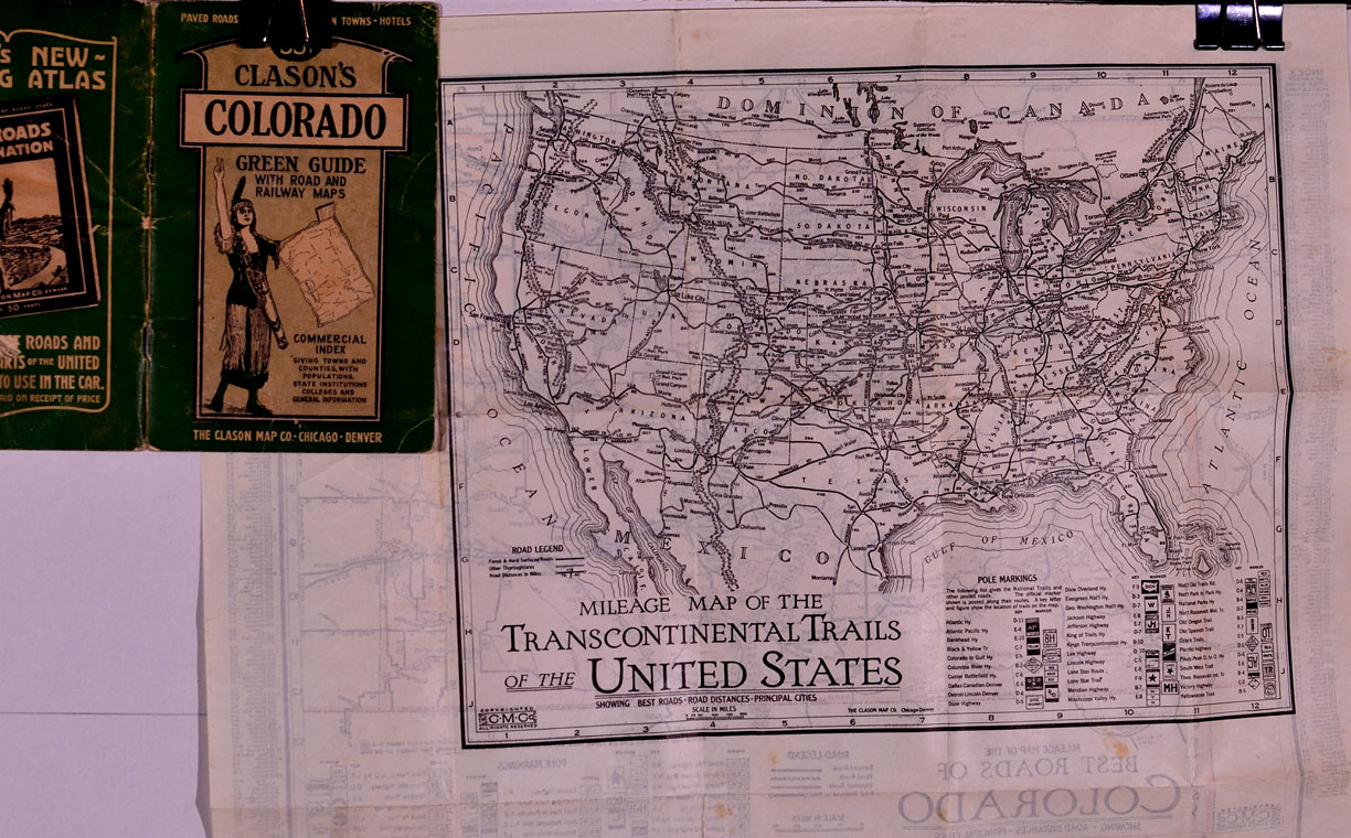
1) MILEAGE MAP OF THE BEST ROADS OF COLORADO, showing road
distances and principal cities; and, 2) MILEAGE MA OF THE TRANSCONTINENTAL
TRAILS OF THE UNITED STATES, showing best roads, road distances, and
principal cities. Dimensions
of folding sheet: 16-1/4 inches across by 13 inches in height.
Condition: near fine. 4
Colorado city street maps on interior pages.
PRICE:
$250.00 |
|
|
|
|
|
|
|
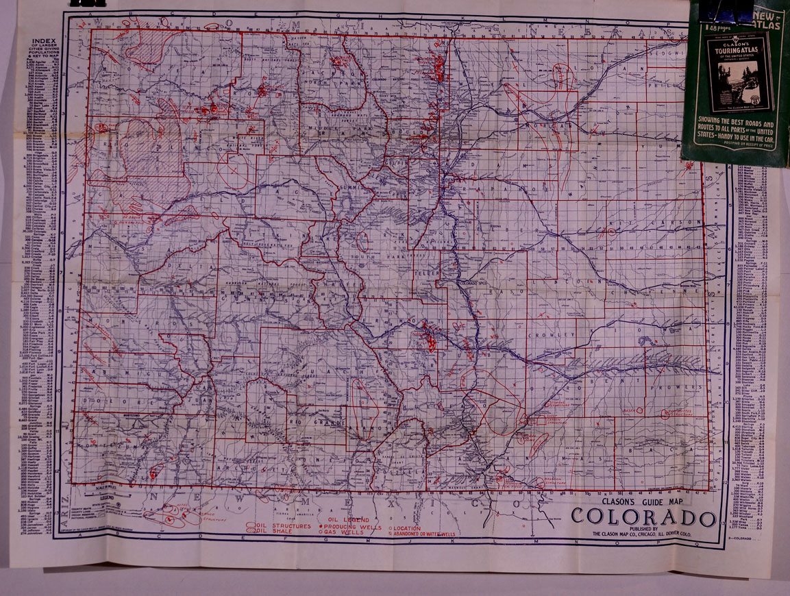
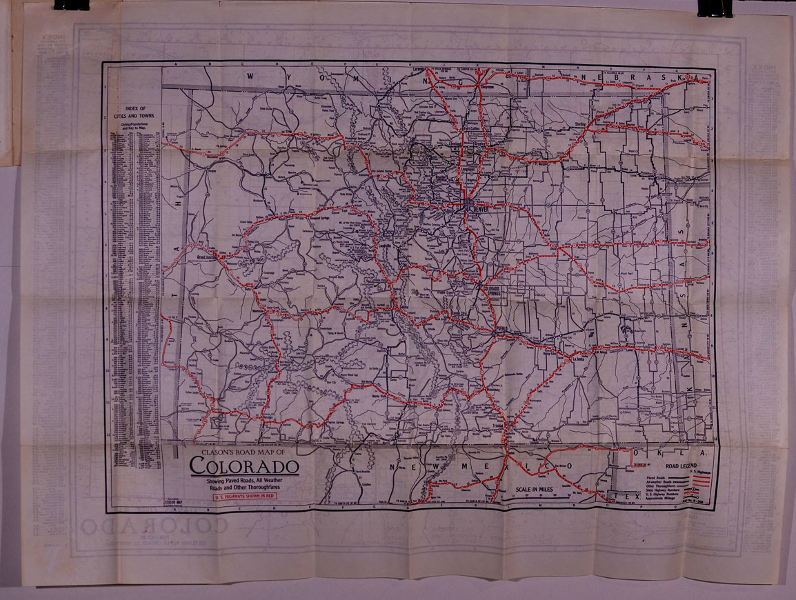
(Clason
Map Company) CLASON’S COLORADO GREEN GUIDE WITH ROAD AND RAILWAY MAPS.
Circa 1926. Commercial
index giving towns and counties, with populations.
State institutions, colleges and general information.
The Clason Map Company, Chicago – Denver.
Original illustrated green booklet with 40-page index and one
foldout sheet with a map printed on either side.
1) CLASON’S ROAD MAP OF COLORADO, showing paved roads, all
weather roads and other thoroughfares; U.S. Highways shown in red; and, 2)
CLASON’S GUIDE MAP: COLORADO, showing best roads, road distances, and
principal cities; also showing oil structures, oil shale, producing wells,
gas wells, abandoned or water wells. Dimensions
of folding sheet: 27-1/4 inches across by 21 inches in height.
Map No. R-208. Condition:
near fine. 4 Colorado city
street maps on interior pages.
PRICE:
$250.00 |
|
|
|
|
|
|
|
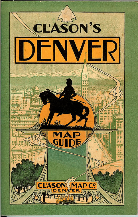
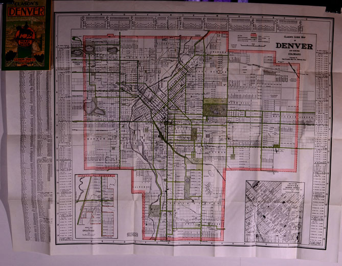
(Clason
Map Company) CLASON’S
DENVER MAP GUIDE. Circa
1928. On foldout map:
CLASON’S GUIDE MAP OF DENVER AND SUBURBS, COLORADO.
Published by the Clason Map Company, Denver.
In original illustrated folder.
Dimensions: 27-1/4 inches across by 21 inches in height.
Red, black and green colored lot and block map with subdivisions.
Inset maps of Denver Business District and Englewood.
Index of Streets on left-hand side of map.
Near fine condition.
PRICE:
$225.00
|
|
|
|
|