|
Site Map
Click on the
following web pages for more offerings:
HOME
About Us
Colorado
Artifactual
Albertype
Publications
Aspen,
Colorado
Business
Directories
Colorado
Colorado
Bottles, historical
Colorado
Business Directories
Colorado Maps
Colorado
Mining Stock Certificates
Colorado
Whiskey Jugs, historical
Cripple Creek,
Colorado
Cripple
Creek Mining Directories
Cripple
Creek mining stock certificates
Denver and
Rio Grande Railroad
Einstein,
Albert
Feynman,
Richard P.
Fitzgerald, F.
Scott
Gunnison
County, Colorado, including Crested Butte
Hecht, Ben
Hemingway,
Ernest
Hutchinson
Soda Bottles
Jackson,
William Henry
Leadville,
Colorado
Leadville
Directories
San Juan
Mountains, Colorado
Silverton
Railroad
|
|
Yes, we Accept:
PAYPAL,
Venmo & SQUARE |
We
are always interested in purchasing, whether you have a single item or an entire
collection for sale.
© 2024 Mt. Gothic Tomes
| |
|
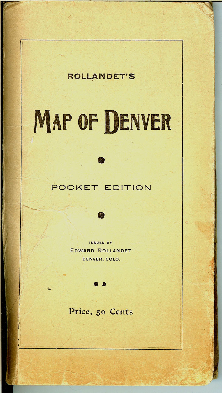
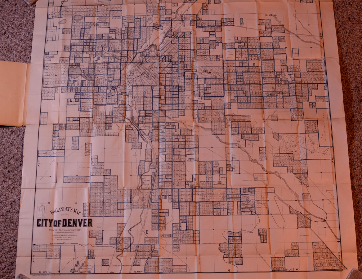
ROLLANDET’S
MAP OF THE CITY OF DENVER, Pocket Edition, April 1st 1891 |
|
|
|
Rollandet,
Edward. ROLLANDET’S MAP OF THE CITY OF DENVER, Pocket Edition, April
1st 1891, compiled, drawn and published by Edward Rollandet, Room 51,
Tabor Block, Denver, Colo. Copyright 1891 by Edward Rollandet. Julius Bien
& Co. Photo. Lith. Details include: City of Denver and additions;
streets, blocks, and lots; topographical; railroads; townships; parks;
rivers, streams, and lakes. 3-color. Dimensions: 35-1/2 inches in width
and 36 inches in height. Very good condition in original stiff printed
cream wrappers: reinforcement of hinges on back of map, also at corners of
folds. |
|
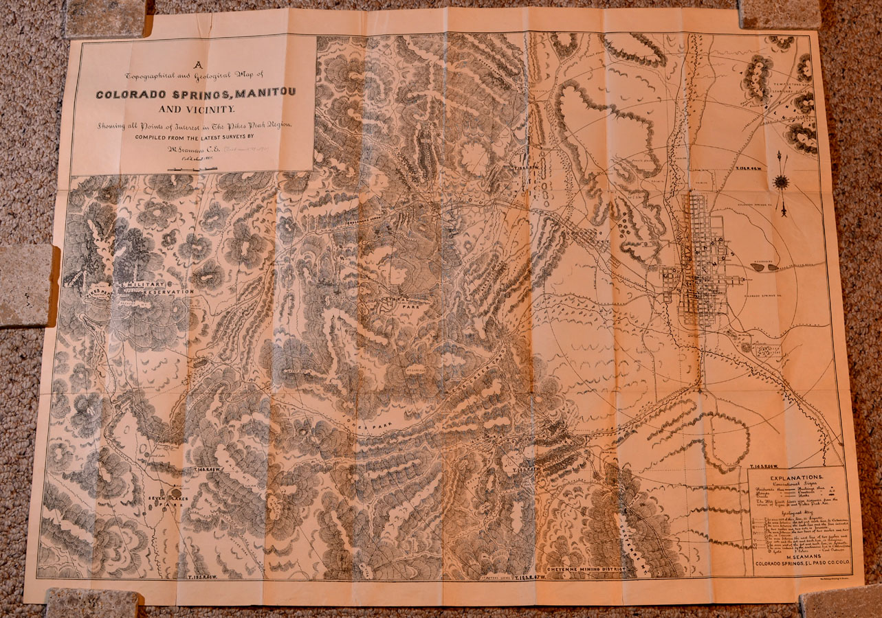
TOURISTS’
MAP OF THE PIKE’S PEAK REGION IN COLORADO, 1884 |
|
|
|
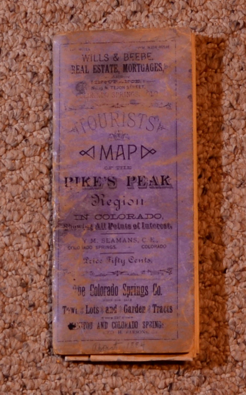
Seamans,
Y.M., C.E. TOURISTS’ MAP OF THE PIKE’S PEAK REGION IN COLORADO, A
Topographical and Geological Map of Colorado Springs, Manitou and Vicinity,
Showing All Points of Interests in the Pike’s Peak Region Compiled from
the Latest Surveys. Published circa 1884 by The Heliotype Printing
Company, Boston. Y.M. Seamans, Colorado Springs, Colorado. Includes plats
of Colorado Springs, Colorado City, and Manitou Springs, and surrounding
settlements; roads, railroads, and trails; townships and topographical
features; U.S. Military Reservation at base of Pike’s Peak; Denver &
Rio Grande Railroad. Dimensions: 28 inches in height and 36 inches in
width; thick bond paper. Overall condition: very good plus; conservation
repair on reverse along some fold lines and corners. In original printed
stiff wrappers; condition: good plus.
SOLD |
|
|
|
THAYER’S
NEW MAP OF THE STATE OF COLORADO, 1878 |
|
|
|
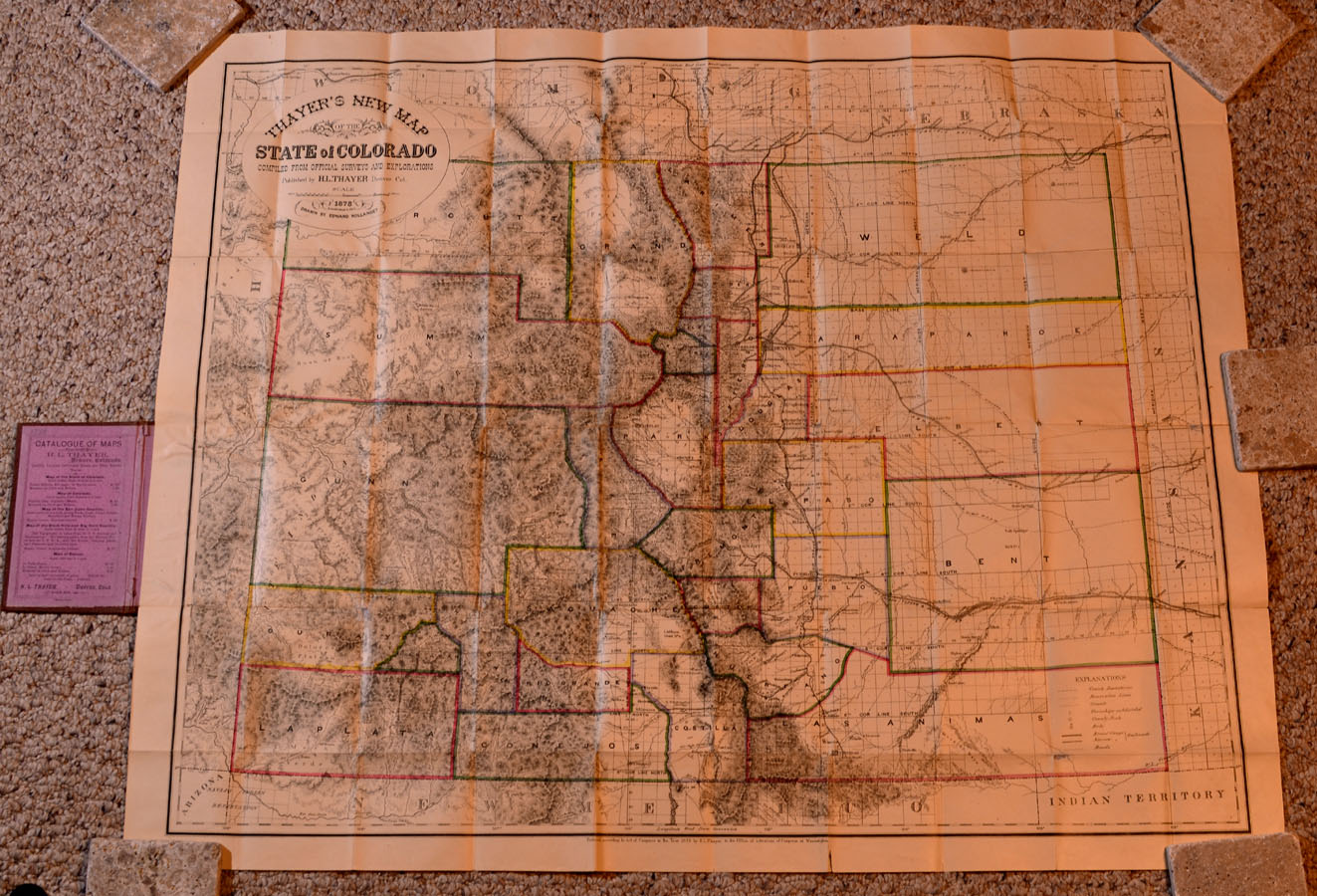
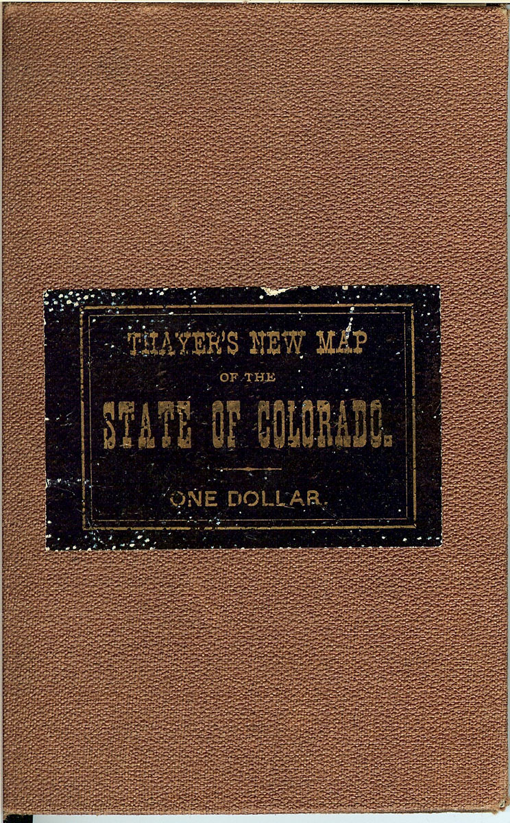
Thayer,
Homer L. Thayer’s New Map of the State of Colorado compiled from
Official Surveys and Explorations, published by H.L. Thayer, Denver,
Col., 1878. Drawn by Edward Rollandet. Lithograph map; counties outlined
in various colors. Dimensions: 33-1/2 inches in width by 27 inches in
height. In original brown cloth covers with tipped on title on front
cover. Condition: very good plus, with some conservation reinforcement to
some hinges and corners on back of map.
SOLD |
|
|
|