|
Site Map
Click on the
following web pages for more offerings:
HOME
About Us
Colorado
Artifactual
Albertype
Publications
Aspen,
Colorado
Business
Directories
Colorado
Colorado
Bottles, historical
Colorado
Business Directories
Colorado Maps
Colorado
Mining Stock Certificates
Colorado
Whiskey Jugs, historical
Cripple Creek,
Colorado
Cripple
Creek Mining Directories
Cripple
Creek mining stock certificates
Denver and
Rio Grande Railroad
Einstein,
Albert
Feynman,
Richard P.
Fitzgerald, F.
Scott
Gunnison
County, Colorado, including Crested Butte
Hecht, Ben
Hemingway,
Ernest
Hutchinson
Soda Bottles
Jackson,
William Henry
Leadville,
Colorado
Leadville
Directories
San Juan
Mountains, Colorado
Silverton
Railroad
|
|
Yes, we Accept:
PAYPAL,
Venmo & SQUARE |
We
are always interested in purchasing, whether you have a single item or an entire
collection for sale.
© 2024 Mt. Gothic Tomes
| |
|
|
|
(Clason
Map Company) CLASON’S IRRIGATION MAP OF THE ARKANSAS VALLEY, COLORADO,
published by the Clason Map Company, Denver, Colorado.
Circa 1910. Pocket map
missing original stiff folding covers.
Showing Crowley, Kiowa, Bent, Prowers, and Otero counties, with the
northern portions of Las Animas and Baca counties; county lines, township
lines, railroads and roads, topography, towns and cities.
Dimensions: 27-1/4 inches across by 18-1/4 inches in height.
Very good plus condition. Printed
for the McClelland Company, Limon, Colorado.
|
|
PRICE:
$300.00 |
|
|
|
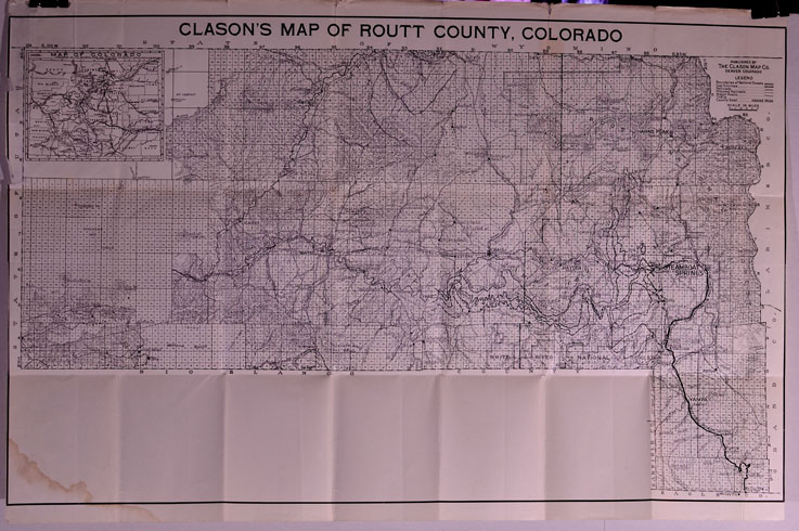
(Clason
Map Company) CLASON’S
MAP OF ROUTT COUNTY, COLORADO, published by The Clason Map
Company, Denver, Colorado, circa 1909.
Pocket map missing original folder.
Map Dimensions: 25-3/4 inches across by 17 inches in height.
Map exhibits towns and cities; roads and railroads; boundaries of
national forests; coal outcrops; proposed railroads; wagon roads and
trails; county seat; streams, rivers, and lakes; townships and topography.
Map folded. Very good
plus condition.
|
|
PRICE:
$300.00
|
|
|
|
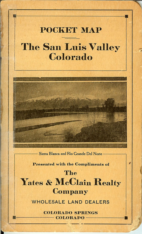
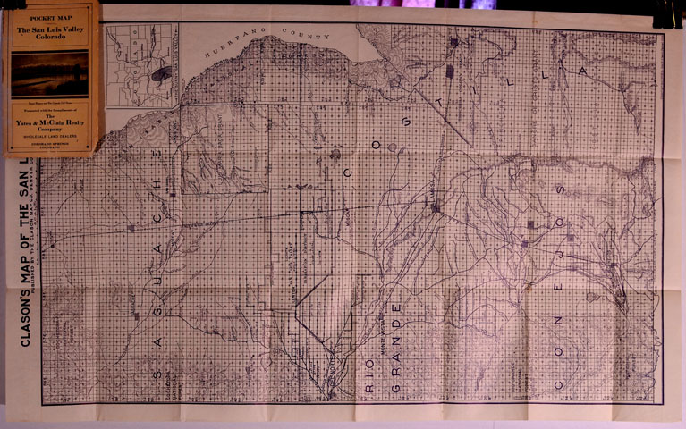
(Clason
Map Company) CLASON’S
MAP OF THE SAN LUIS VALLEY, published by The Clason Map Company,
Denver, Colorado, 1908. Pocket
Map: The San Luis Valley, Colorado. Sierra
Blanca and Rio Grande Del Norte. Presented
with the Compliments of The Yates & McClain Realty Company, Wholesale
Land Dealers, Colorado Springs, Colorado.
“Map of Colorado Showing Location of The ‘Sunny’ San Luis
Valley.” Dimensions: 17
inches across by 27-3/4 inches in height.
Highly detailed showing cities, towns, and villages, railroad and
roads, townships, and topography. Near
fine condition. In original
stiff pictorial wrappers.
PRICE:
$350.00
|
|
|
|
|
|
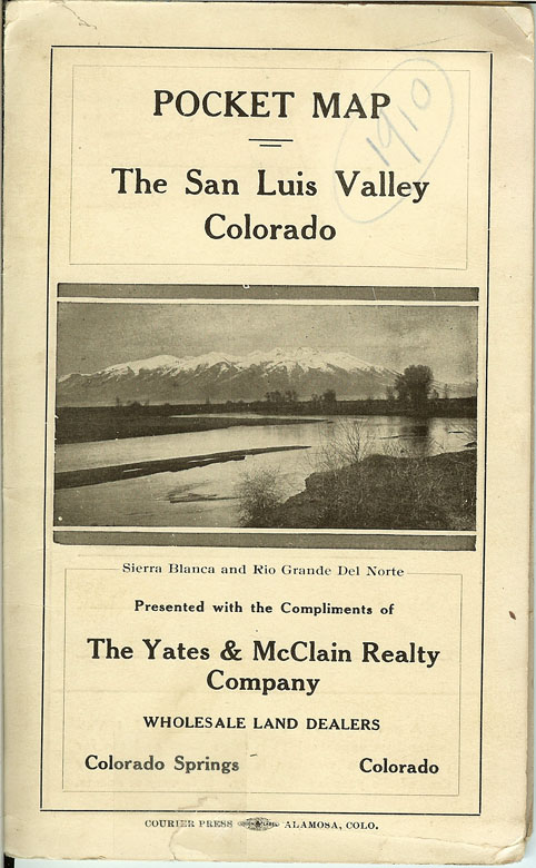
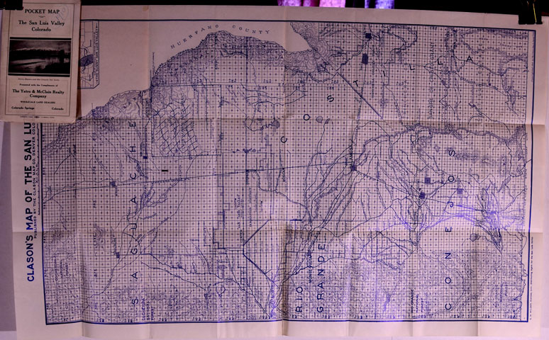
(Clason
Map Company) CLASON’S
MAP OF THE SAN LUIS VALLEY, published by The Clason Map Company,
Denver, Colorado, 1910. Pocket
Map: The San Luis Valley, Colorado. Sierra
Blanca and Rio Grande Del Norte. Presented
with the Compliments of The Yates & McClain Realty Company, Wholesale
Land Dealers, Colorado Springs, Colorado.
C. H. Wilder, Alamosa, Colo., Distributing Agent for the San Luis
Valley. “Map of Colorado
Showing Location of The ‘Sunny’ San Luis Valley.”
Dimensions: 17 inches across by 27-3/4 inches in height.
Highly detailed showing cities, towns, and villages, railroad and
roads, townships, and topography. Near
fine condition. In original
stiff pictorial wrappers.
PRICE:
$350.00
|
|
|
|
|
|
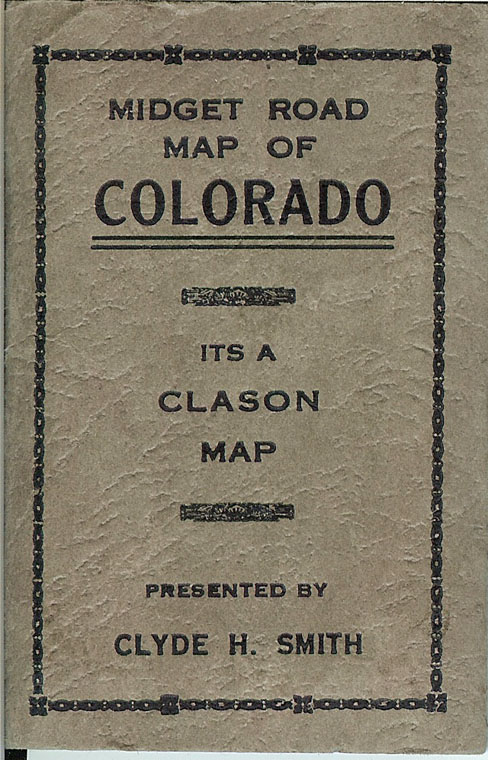
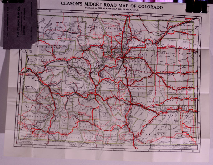
(Clason
Map Company) CLASON’S
MIDGET ROAD MAP OF COLORADO, Published by The Clason Map Co.,
Denver, Colo, ca. 1918 (1515 Tremont Place).
Pocket map in original printed gray folder.
Presented by Clyde H. Smith. “Maps
for every Purpose: Art Designs, Photo Engravings, Draftings, Blueprints,
Planning and Printing of Advertising Booklets.”
Map dimensions: 12 inches across by 10 inches in height.
Printed in black, green and red.
Near fine condition. PRICE:
$175.00
|
|
|
|
|
|
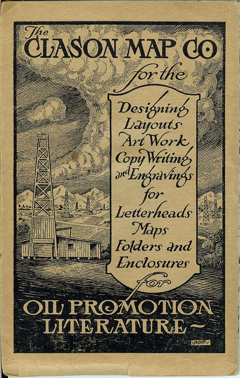
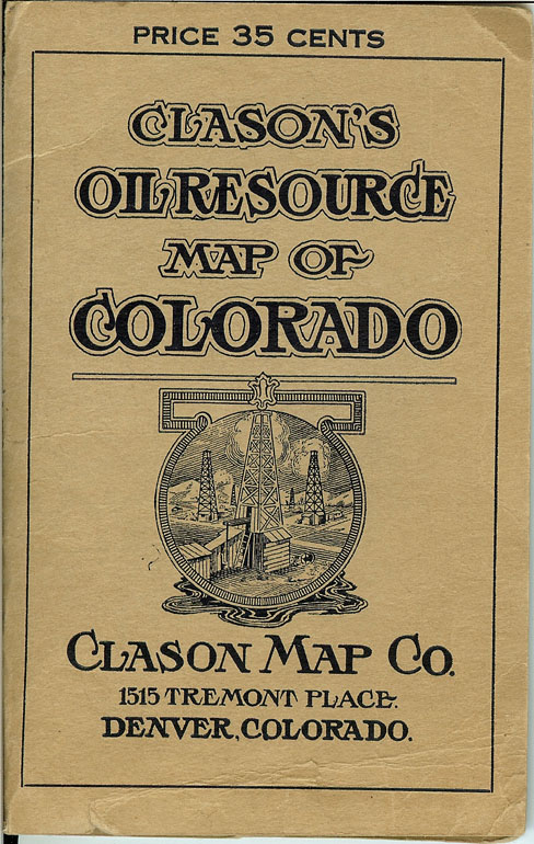
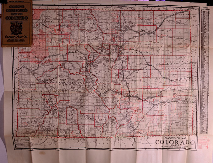
(Clason
Map Company) CLASON’S
OIL RESOURCE MAP OF COLORADO, Clason Map Co., 1515 Tremont Place,
Denver, Colorado, circa 1918. Original
illustrated gray stiff folder. Pocket
map. Map title: CLASON’S OIL MAP OF COLORADO.
The Clason Map Co., Chicago, Ill., Denver, Co.
Dimensions: 27-1/4 inches across and 22 inches in height.
Black and red print. Legend:
state capitol; county seats; county lines; Indian reserves; National
Forest boundaries; National Park boundaries; railroads; trunk line
railroads; electric railways; paved roads; graded dirt roads and other
roads. Oil Resources legend:
anti-clinal area; anticlines; bitumen & oil sands; oil & gas in
water well seeps, etc.; oil & gas indicated by drilling; oil fields;
oil shale; oil wells; gas wells. Near
fine condition.
SOLD
|
|
|
|